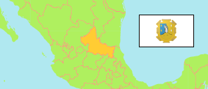
State
The population development of the State of San Luis Potosí according to census results.
| Name | Abbr. | Status | Capital | Area A-L (km²) | Population Census (C) 1990-03-12 | Population Census (C) 1995-11-05 | Population Census (C) 2000-02-14 | Population Census (C) 2005-10-17 | Population Census (Cf) 2010-05-31 | Population Census (C) 2020-03-15 | |||
|---|---|---|---|---|---|---|---|---|---|---|---|---|---|
| Mexico | MEX | Fed Rep | Ciudad de México | 1,959,248 | 81,249,645 | 91,120,433 | 97,483,412 | 103,263,388 | 112,336,538 | 126,014,024 | |||
| San Luis Potosí | SLP | FSt | San Luis Potosí | 60,983 | 2,003,187 | 2,200,763 | 2,299,360 | 2,410,414 | 2,585,518 | 2,822,255 | 6098300 | → |
- Instituto Nacional de Estadística Geografía e Informática, México (web).
Major Cities
| Name | Population Census (C) 2020-03-15 | |
|---|---|---|
| 1 | San Luis Potosí | 845,941 |
| 2 | Soledad de Graciano Sánchez | 310,192 |
| 3 | Ciudad Valles | 136,351 |
| 4 | Matehuala | 86,686 |
| 5 | Rioverde | 58,158 |
Contents: Cities & Towns
The population of all urban localities (localidades) in the State of San Luis Potosí with more than 20,000 inhabitants according to census results.
| Name | Population Census (C) 1990-03-12 | Population Census (C) 1995-11-05 | Population Census (C) 2000-02-14 | Population Census (C) 2005-10-17 | Population Census (Cf) 2010-05-31 | Population Census (C) 2020-03-15 | Area | ||
|---|---|---|---|---|---|---|---|---|---|
| Ciudad Fernández | 20,882 | 24,698 | 27,066 | 29,598 | 32,012 | 36,275 | 2170 | → | |
| Ciudad Valles | 91,402 | 102,226 | 105,721 | 116,261 | 124,644 | 136,351 | 3615 | → | |
| Ébano (Empalme) | 24,340 | 22,777 | 22,133 | 22,181 | 24,296 | 24,454 | 1110 | → | |
| Matehuala | 54,713 | 60,726 | 64,206 | 70,150 | 77,328 | 86,686 | 2320 | → | |
| Rioverde (Río Verde) | 42,073 | 44,226 | 47,021 | 49,536 | 53,128 | 58,158 | 2045 | → | |
| San Luis Potosí | 489,238 | 586,585 | 629,254 | 687,780 | 724,252 | 845,941 | 16336 | → | |
| Soledad de Graciano Sánchez | 123,943 | 147,188 | 169,574 | 216,348 | 255,045 | 310,192 | 3633 | → | |
| Tamazunchale | 19,223 | 20,573 | 22,255 | 23,602 | 24,568 | 24,258 | 431 | → |
- The tabulated population figures (apart from 1990 and 1995) consider amalgamations of localities since 2000.
- Instituto Nacional de Estadística Geografía e Informática, México (web).