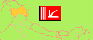
Jammu and Kashmir state was split into the Jammu and Kashmir union territory and Ladakh union territory with effect from 31 October 2019. The areas are disputed between India, Pakistan and China. The northwestern areas are under control of Pakistan and northeastern areas are controlled by China.
Union Territory
The population development of the Union Territory of Jammu and Kashmīr according to census results and latest projections.
| Name | Abbr. | Status | Capital | Area A (km²) | Population Census (Cf) 1991-03-01 | Population Census (Cf) 2001-03-01 | Population Census (Cf) 2011-03-01 | Population Projection (P) 2023-03-01 | |||
|---|---|---|---|---|---|---|---|---|---|---|---|
| India | IND | Rep | New Delhi | 3,166,620 | 846,387,888 | 1,028,737,436 | 1,210,854,977 | 1,387,284,900 | → | ||
| Jammu & Kashmīr | JAM | UTerr | Srīnagar / Jammu | 42,241 | 7,656,000 | 9,907,161 | 12,267,013 | 13,603,000 | 4224100 | → |
- Office of the Registrar General and Census Commissioner.
(2023) National Commission on Population (adapted by Unique Identification Authority of India).
Major Agglomerations
| Name | Population Census (Cf) 2011-03-01 | |
|---|---|---|
| 1 | Srīnagar | 1,264,202 |
| 2 | Jammu | 657,314 |
| 3 | Anantnāg | 159,838 |
| 4 | Udhampur | 91,366 |
| 5 | Bāramūla | 71,434 |
| 6 | Sopore | 71,292 |
| 7 | Kathua | 59,866 |
| 8 | Bandipura | 37,081 |
Contents: Agglomerations & Cities
The population development of all urban agglomerations and single cities in Jammu and Kashmīr with more than 20,000 inhabitants by census years.
| Name | Status | Population Census (Cf) 2001-03-01 | Population Census (Cf) 2011-03-01 | Area | ||
|---|---|---|---|---|---|---|
| Akhnoor | City | 10,896 | 20,756 | 185 | → | |
| Anantnāg | Aggl | 97,896 | 159,838 | 3930 | → | |
| Bandipura (Bandipore) | City | 25,795 | 37,081 | 1340 | → | |
| Bāramūla (Baramulla) | CityOG | 71,896 | 71,434 | 3280 | → | |
| Bijbiāra (Bijbehara) | City | 19,794 | 22,789 | 240 | → | |
| Doda | City | 11,320 | 21,605 | 1425 | → | |
| Duru Verinag | City | 17,237 | 22,968 | 1230 | → | |
| Ganderbal | City | 13,721 | 28,233 | 772 | → | |
| Jammu | Aggl | 612,163 | 657,314 | 20159 | → | |
| Kathua | CityOG | 51,034 | 59,866 | 2831 | → | |
| Kulgām | City | 13,136 | 23,584 | 1280 | → | |
| Kupwāra | City | 14,857 | 21,771 | 410 | → | |
| Pūnch (Poonch) | City | 23,978 | 26,854 | 1036 | → | |
| Raipur Domana | Town | 13,748 | 20,238 | 0 | → | |
| Rājauri (Rajouri) | City | 21,580 | 29,486 | 1289 | → | |
| Sopore | CityOG | 59,624 | 71,292 | 2870 | → | |
| Srīnagar [Srinagar] | Aggl | 988,210 | 1,264,202 | 24261 | → | |
| Udhampur | Aggl | 86,299 | 91,366 | 3535 | → |
- (2001) (2011) Office of the Registrar General and Census Commissioner, Delimitation Commission of India, Population Census India.
