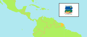
FranzûÑsisch-Guayana ist als ûbersee-Dûˋpartement integraler Bestandteil der FranzûÑsischen Republik und damit auch der EuropûÊischen Union.
Arrondissements
Die FlûÊche und Einwohnerzahlen der Arrondissements von FranzûÑsisch-Guayana nach VolkszûÊhlungen und neuesten amtlichen Festsetzungen.
| Name | Abk. | Hauptstadt | FlûÊche A (kmôý) | Einwohner Zensus (C) 1982-03-09 | Einwohner Zensus (C) 1990-03-15 | Einwohner Zensus (C) 1999-03-08 | Einwohner SchûÊtzung (E) 2007-01-01 | Einwohner SchûÊtzung (E) 2015-01-01 | Einwohner SchûÊtzung (E) 2021-01-01 | Einwohner SchûÊtzung (Ep) 2024-01-01 | |||
|---|---|---|---|---|---|---|---|---|---|---|---|---|---|
| FranzûÑsisch-Guayana | GUF | Cayenne | 83.534 | 73.022 | 114.678 | 157.213 | 213.031 | 259.865 | 286.618 | 295.385 | |||
| Cayenne | CAY | Cayenne | 17.029 | 59.246 | 85.808 | 115.618 | 145.607 | 163.073 | 180.493 | ... | 1702900 | ||
| Saint-Georges | SGE | Saint-Georges | 25.560 | 2.341 | 2.881 | 4.042 | 5.985 | 6.900 | 8.557 | ... | 2556000 | ||
| Saint-Laurent-du-Maroni | SLM | Saint-Laurent-du-Maroni | 40.945 | 11.435 | 25.989 | 37.553 | 61.439 | 89.892 | 97.568 | ... | 4094500 |
- Institut National de la Statistique et des Etudes Economiques, France.
Die grûÑûten Gemeinden
| Name | Adm. | Einwohner SchûÊtzung (E) 2021-01-01 | |
|---|---|---|---|
| 1 | Cayenne | CAY | 63.468 |
| 2 | Saint-Laurent-du-Maroni | SLM | 50.250 |
| 3 | Matoury | CAY | 34.810 |
| 4 | Remire-Montjoly | CAY | 27.274 |
| 5 | Kourou | CAY | 24.612 |
Die grûÑûten Agglomerationen
| Name | Adm. | Einwohner SchûÊtzung (E) 2021-01-01 | |
|---|---|---|---|
| 1 | Cayenne | CAY | 125.552 |
ûbersicht: Gemeinden
Die Einwohnerzahlen aller Gemeinden in FranzûÑsisch-Guayana nach VolkszûÊhlungen und neuesten amtlichen Festsetzungen.
| Name | Adm. | Einwohner Zensus (C) 1982-03-09 | Einwohner Zensus (C) 1990-03-15 | Einwohner Zensus (C) 1999-03-08 | Einwohner SchûÊtzung (E) 2007-01-01 | Einwohner SchûÊtzung (E) 2015-01-01 | Einwohner SchûÊtzung (E) 2021-01-01 | Area | |
|---|---|---|---|---|---|---|---|---|---|
| Apatou | SLM | 618 | 2.451 | 3.628 | 6.357 | 8.431 | 9.818 | 202000 | |
| Awala-Yalimapo | SLM | 292 | 630 | 887 | 1.251 | 1.379 | 1.516 | 18700 | |
| Camopi | SGE | 554 | 748 | 1.032 | 1.469 | 1.769 | 2.146 | 1003000 | |
| Cayenne | CAY | 38.091 | 41.067 | 50.594 | 58.008 | 57.614 | 63.468 | 2400 | |
| Grand-Santi | SLM | 754 | 1.786 | 2.862 | 3.427 | 6.969 | 9.120 | 211200 | |
| Iracoubo | CAY | 938 | 1.578 | 1.430 | 1.975 | 1.878 | 1.707 | 276200 | |
| Kourou | CAY | 7.061 | 13.873 | 19.107 | 25.688 | 26.221 | 24.612 | 216000 | |
| Macouria | CAY | 446 | 2.069 | 5.050 | 8.191 | 11.719 | 18.847 | 37800 | |
| Mana | SLM | 1.429 | 4.945 | 5.445 | 8.256 | 10.241 | 11.764 | 633300 | |
| Maripasoula | SLM | 1.007 | 1.748 | 3.710 | 5.545 | 11.856 | 9.177 | 1836000 | |
| Matoury | CAY | 2.532 | 10.152 | 18.032 | 24.893 | 32.427 | 34.810 | 13700 | |
| Montsinûˋry-Tonnegrande | CAY | 333 | 500 | 1.037 | 1.958 | 2.473 | 3.295 | 60000 | |
| Ouanary | SGE | 89 | 82 | 92 | 85 | 165 | 251 | 108000 | |
| Papaû₤chton | SLM | 297 | 750 | 1.650 | 2.296 | 7.266 | 5.606 | 262800 | |
| Rûˋgina | SGE | 499 | 528 | 765 | 826 | 946 | 1.655 | 1213000 | |
| Remire-Montjoly | CAY | 6.773 | 11.701 | 15.555 | 18.511 | 23.976 | 27.274 | 4600 | |
| Roura | CAY | 943 | 1.314 | 1.791 | 2.823 | 3.713 | 3.409 | 390200 | |
| Saint-ûlie | CAY | 138 | 123 | 239 | 450 | 95 | 241 | 568000 | |
| Saint-Georges | SGE | 1.199 | 1.523 | 2.153 | 3.605 | 4.020 | 4.505 | 232000 | |
| Saint-Laurent-du-Maroni | SLM | 6.971 | 13.616 | 19.211 | 34.149 | 43.600 | 50.250 | 483000 | |
| Saû¥l | SLM | 67 | 63 | 160 | 158 | 150 | 317 | 447500 | |
| Sinnamary | CAY | 1.991 | 3.431 | 2.783 | 3.110 | 2.957 | 2.830 | 134000 |
- Since 2006, France computes the population by using census results of different years. Agglomerations in the boundaries as defined in 2020.
- Institut National de la Statistique et des Etudes Economiques, France.
BevûÑlkerungsstruktur
Weitere Informationen û¥ber die BevûÑlkerungsstruktur.
| Geschlecht (E 2020) | |
|---|---|
| mûÊnnlich | 139.072 |
| weiblich | 146.061 |
| Altersgruppen (E 2020) | |
|---|---|
| 0-17 Jahre | 110.551 |
| 18-64 Jahre | 158.125 |
| ãË65 Jahre | 16.459 |
| Alterspyramide (E 2020) | |
|---|---|
| ãË90 Jahre | 504 |
| 80-89 Jahre | 2.590 |
| 70-79 Jahre | 6.853 |
| 60-69 Jahre | 15.724 |
| 50-59 Jahre | 26.271 |
| 40-49 Jahre | 34.360 |
| 30-39 Jahre | 39.774 |
| 20-29 Jahre | 38.637 |
| 10-19 Jahre | 57.867 |
| 0-9 Jahre | 62.546 |
| StaatsangehûÑrigkeit (E 2020) | |
|---|---|
| Frankreich | 182.349 |
| ûbrige | 102.784 |