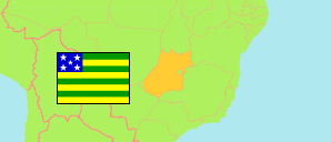
State
The population development of the State of Goiás according to census results and latest official population estimates.
| Name | Abbr. | Status | Capital | Area A (km²) | Population Census (Cf) 1991-09-01 | Population Census (Cf) 2000-08-01 | Population Census (Cf) 2010-08-01 | Population Census (C) 2022-08-01 | Population Estimate (E) 2025-07-01 | ||
|---|---|---|---|---|---|---|---|---|---|---|---|
| Goiás | GO | FSt | Goiânia | 340,243 | 4,018,903 | 5,003,228 | 6,001,789 | 7,056,495 | 7,423,629 | 34024300 | → |
| Brazil | BRA | Fed Rep | Brasília | 8,510,418 | 146,825,475 | 169,799,170 | 190,755,799 | 203,080,756 | 213,421,037 |
- The population estimates for 2025 are based on adjusted results of the 2010 and 2022 census.
- Instituto Brasileiro de Geografia e Estatistica.
Major Cities
| Name | Population Calculation (UE-E) 2025-07-01 | |
|---|---|---|
| 1 | Goiânia | 1,500,980 |
| 2 | Aparecida de Goiânia | 555,370 |
| 3 | Anápolis | 409,050 |
| 4 | Águas Lindas de Goiás | 244,790 |
| 5 | Rio Verde | 224,490 |
| 6 | Valparaíso de Goiás | 218,420 |
| 7 | Luziânia | 212,800 |
| 8 | Senador Canedo | 173,830 |
| 9 | Trindade | 150,390 |
Contents: Cities & Towns
The population of all cities and towns in the State of Goiás with more than 20,000 inhabitants according to census results and latest calculations.
The listed places consist of the urban areas of one or more municipal districts of one municipality. In the case of several districts, their urban areas form (more or less) a conurbation.
| Name | Population Census (Cf) 2000-08-01 | Population Census (Cf) 2010-08-01 | Population Census (C) 2022-08-01 | Population Calculation (UE-E) 2025-07-01 | Area | |
|---|---|---|---|---|---|---|
| Abadia de Goiás | 3,096 | 5,081 | 18,450 | 21,270 | 2843 | → |
| Acreúna | 15,883 | 17,696 | 20,350 | 20,830 | 968 | → |
| Águas Lindas de Goiás | 105,583 | 159,138 | 225,174 | 244,790 | 10874 | → |
| Alexânia | 14,911 | 18,719 | 23,820 | 24,910 | 14643 | → |
| Anápolis | 274,642 | 325,583 | 388,195 | 409,050 | 16856 | → |
| Aparecida de Goiânia | 335,547 | 455,193 | 527,178 | 555,370 | 18987 | → |
| Bela Vista de Goiás | 12,278 | 17,955 | 25,439 | 27,550 | 2031 | → |
| Bom Jesus de Goiás | 14,746 | 19,253 | 22,774 | 23,690 | 698 | → |
| Caldas Novas | 47,308 | 67,714 | 96,119 | 104,110 | 11692 | → |
| Catalão | 56,224 | 79,046 | 106,426 | 114,180 | 5117 | → |
| Ceres | 18,123 | 19,790 | 21,025 | 21,520 | 1080 | → |
| Cidade Ocidental | 34,465 | 43,654 | 90,865 | 100,570 | 5557 | → |
| Cocalzinho de Goiás | 6,000 | 6,444 | 18,883 | 20,530 | 1772 | → |
| Cristalina | 25,102 | 32,131 | 40,599 | 43,520 | 2941 | → |
| Formosa | 68,477 | 88,286 | 103,467 | 108,520 | 3913 | → |
| Goianésia | 44,705 | 55,478 | 69,838 | 73,910 | 3712 | → |
| Goiânia | 1,085,806 | 1,297,076 | 1,435,186 | 1,500,980 | 44038 | → |
| Goianira | 18,064 | 33,451 | 71,265 | 80,760 | 4792 | → |
| Goiatuba | 26,812 | 29,197 | 32,734 | 33,950 | 1456 | → |
| Hidrolândia | 7,836 | 10,470 | 22,896 | 25,240 | 3203 | → |
| Inhumas | 39,976 | 45,103 | 49,143 | 50,720 | 2328 | → |
| Ipameri | 17,413 | 18,080 | 18,672 | 19,160 | 1363 | → |
| Iporá | 28,192 | 28,545 | 33,015 | 34,490 | 2206 | → |
| Itaberaí | 21,249 | 29,784 | 38,843 | 41,330 | 1676 | → |
| Itapaci | 11,867 | 16,595 | 19,432 | 20,170 | 729 | → |
| Itapuranga | 19,134 | 20,519 | 20,869 | 21,220 | 1295 | → |
| Itumbiara | 77,123 | 88,942 | 104,492 | 109,670 | 5430 | → |
| Jaraguá | 24,673 | 35,328 | 39,287 | 40,510 | 1898 | → |
| Jataí | 68,821 | 81,010 | 99,668 | 105,230 | 3964 | → |
| Luziânia | 130,165 | 162,807 | 201,126 | 212,800 | 19060 | → |
| Minaçu | 28,426 | 26,091 | 23,056 | 22,660 | 3443 | → |
| Mineiros | 34,660 | 48,286 | 65,641 | 70,250 | 3463 | → |
| Morrinhos | 30,929 | 35,959 | 46,231 | 48,910 | 2230 | → |
| Nerópolis | 17,253 | 23,229 | 30,954 | 33,220 | 1465 | → |
| Niquelândia | 25,718 | 32,042 | 26,038 | 25,240 | 5568 | → |
| Novo Gama | 73,026 | 93,971 | 103,275 | 107,110 | 8349 | → |
| Palmeiras de Goiás | 13,500 | 19,166 | 28,251 | 30,480 | 1024 | → |
| Piracanjuba | 16,177 | 17,551 | 19,852 | 20,240 | 1174 | → |
| Pires do Rio | 24,473 | 27,094 | 30,348 | 31,630 | 1228 | → |
| Planaltina | 69,387 | 76,286 | 97,030 | 103,750 | 6126 | → |
| Porangatu | 33,423 | 35,731 | 39,083 | 40,140 | 3111 | → |
| Posse | 18,388 | 23,939 | 28,772 | 29,910 | 1713 | → |
| Quirinópolis | 30,822 | 38,163 | 44,921 | 46,670 | 2553 | → |
| Rio Verde | 103,374 | 160,800 | 209,802 | 224,490 | 7850 | → |
| Santa Helena de Goiás | 32,349 | 34,815 | 36,917 | 37,980 | 1849 | → |
| Santo Antônio do Descoberto | 48,398 | 56,808 | 68,889 | 71,840 | 13582 | → |
| São Luís de Montes Belos | 21,950 | 26,333 | 30,820 | 32,130 | 1598 | → |
| Senador Canedo | 50,442 | 84,111 | 154,556 | 173,830 | 9191 | → |
| Trindade | 78,199 | 100,106 | 139,492 | 150,390 | 8425 | → |
| Uruaçu | 30,069 | 33,748 | 39,258 | 41,090 | 3638 | → |
| Valparaíso de Goiás | 94,856 | 132,982 | 198,861 | 218,420 | 6149 | → |
- The urban population for 2025 is calculated by »City Population« using the urban population according to the 2022 census and latest official population estimates for the total municipality that are based on adjusted results of the 2010 and 2022 census.
- Instituto Brasileiro de Geografia e Estatistica.
Population Structure
Further information about the population structure.
| Gender (C 2022) | |
|---|---|
| Males | 3,466,941 |
| Females | 3,589,554 |
| Age Groups (C 2022) | |
|---|---|
| 0-14 years | 1,431,289 |
| 15-64 years | 4,976,333 |
| 65+ years | 648,873 |
| Age Distribution (C 2022) | |
|---|---|
| 90+ years | 18,681 |
| 80-89 years | 105,118 |
| 70-79 years | 284,922 |
| 60-69 years | 555,696 |
| 50-59 years | 823,795 |
| 40-49 years | 1,065,838 |
| 30-39 years | 1,143,567 |
| 20-29 years | 1,118,788 |
| 10-19 years | 984,440 |
| 0-9 years | 955,650 |
| Urbanization (C 2022) | |
|---|---|
| Rural | 480,391 |
| Urban | 6,576,104 |
| Ethnic Group (C 2022) | |
|---|---|
| Indigenous | 19,517 |
| Non-Indigenous | 7,036,978 |
| Color (C 2022) | |
|---|---|
| Black | 648,560 |
| White | 2,557,454 |
| Mixed / Other | 3,850,281 |
| Literacy (A15+) (C 2022) | |
|---|---|
| yes | 5,316,507 |
| no | 308,699 |